Walks near Vernet-les-Bains and to Canigou
OTHER WALKS - in (and close to) CONFLENT
Conflent is a region within the Pyrénées-Orientales (eastern Pyrenees) which lies in the central part of the catchment area of the River Têt. It extends from Mont-Louis in the west to Vinça in the east, and from Mosset in the north to Mantet in the south. Vernet-les-Bains and the northern part of the Canigou massif lie within Conflent. As an administrative unit, Conflent has a history extending back to medieval times.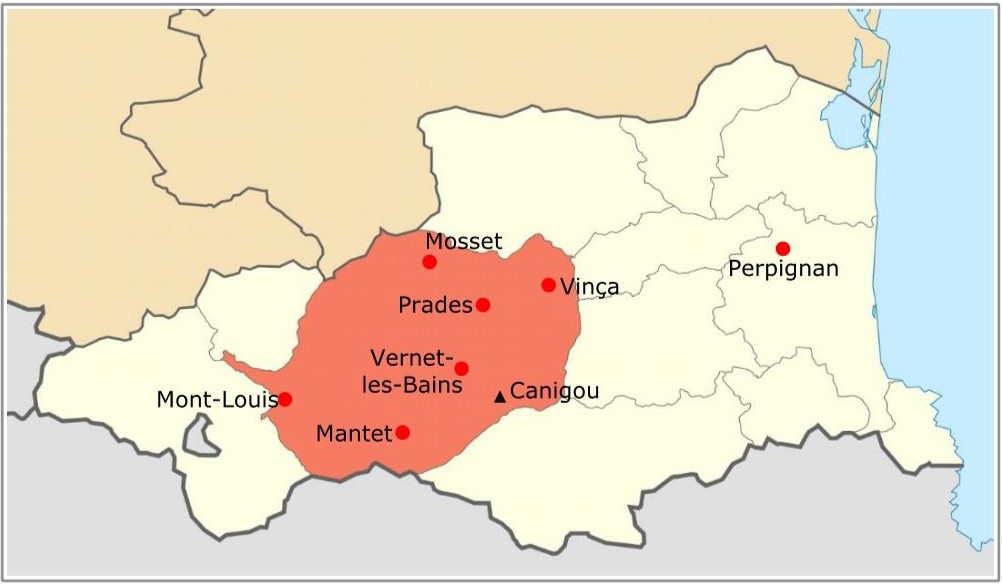
All the descriptions in the list of walks below are in pdf format.
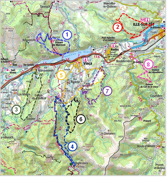
Walks in the eastern sector of Conflent
Walks in the central sector of Conflent
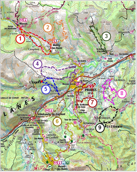
1 - Molitg-les-Bains - Campôme - Mosset: pdf
2 - Molitg-les-Bains - dolmen - les Planes:
- pdf (for viewing and printing)
- pdf (for smartphone)
- gpx file
3 - Eus - Comes: pdf
4 - Prades and the Vallensó plateau: pdf
5 - Ria, Llugols and the "majestic pine tree":
- pdf (for viewing and printing)
- pdf (for smartphone)
- gpx file
6 - Sirach (Ria) - Ambullas plateau:
- pdf (for viewing and printing)
- pdf (for smartphone)
- gpx file
7 - Prades - the "two canals" walk:
- pdf (for viewing and printing)
- pdf (for smartphone)
- gpx file
8 - Los Masos - Canal de Bohère:
- pdf (for viewing and printing)
- pdf (for smartphone)
- gpx file
9 - Villerach - St Etienne chapel: pdf
Walks in the western sector of Conflent
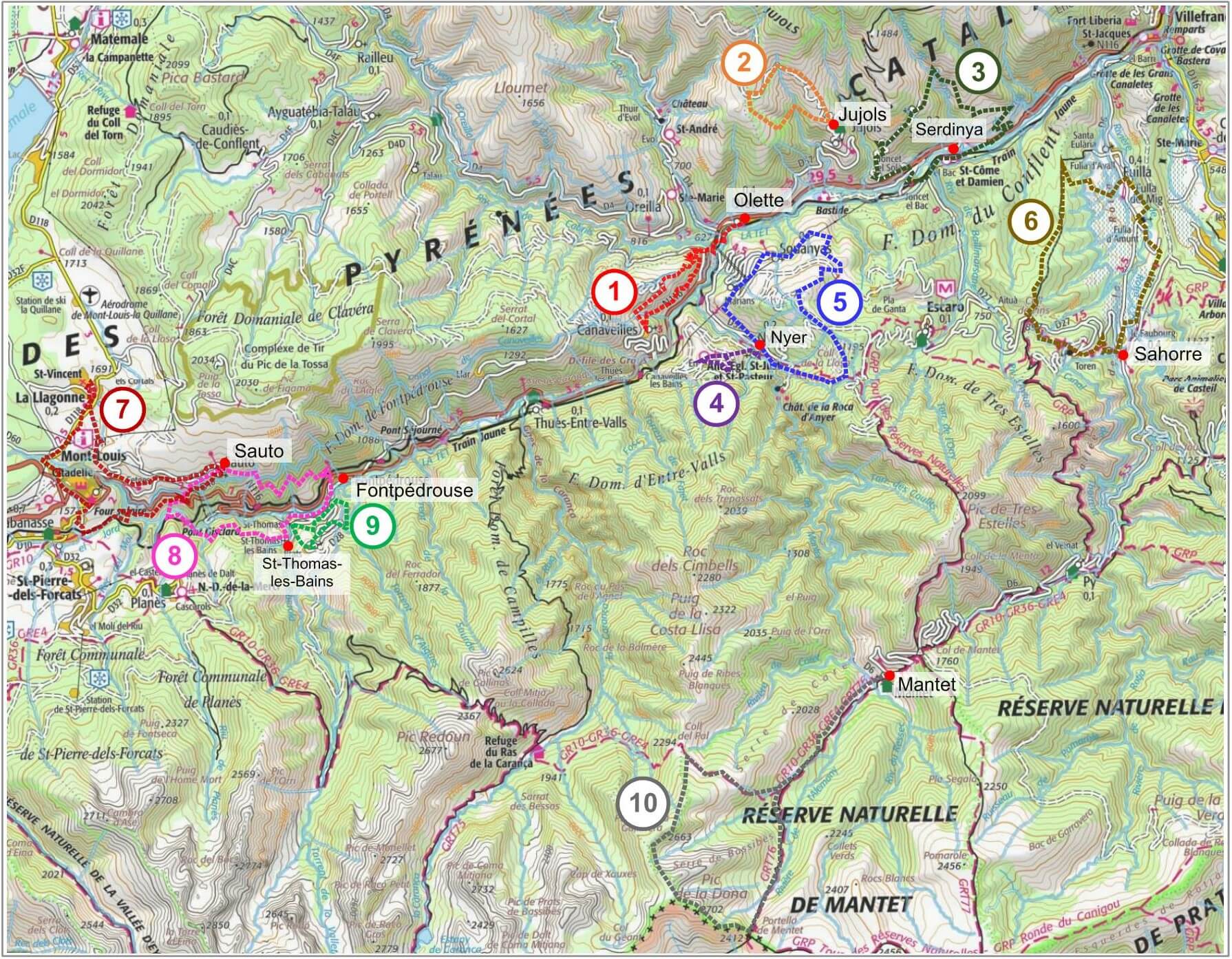
2 - Jujols: on the Chemin Vauban: pdf
3 - Joncet - Serdinya - Flassa: pdf
4 - Nyer to En ("the abandoned village"): pdf
5 - Nyer - Marians - Souanyas: pdf
6 - Sahorre - Fuilla (the Rotja valley): pdf
7 - Mont-Louis - Sauto - La Llagonne: pdf
8 - Fontpedrouse - Sauto - St-Thomas-les-Bains: pdf
9 - St-Thomas-les-Bains:
- pdf (for viewing and printing)
- pdf (for smartphone)
- gpx file
10 - Mantet - Pic de la Dona (2702m): pdf