4 hours; climb: 500m
A walk on undulating paths in the hills between Vernet-les-Bains and Fillols, mainly in a delightful, sunlit forest.
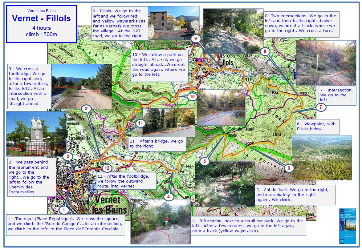
1 - THE START (Place République). We cross the square, and we climb the 'Rue du Canigou'... At an intersection, we climb to the left, to the Place de l'Entente Cordiale.
2 - We pass behind the monument and we go to the right... We go to the left to follow the Chemin des Escoumeilles.
3 - We cross a footbridge. We go to the right and, after a few metres, to the left... At an intersection with a road, we go straight ahead, on a narrow lane.
4 - Bifurcation, soon after a small car park. We go to the left, still on a lane... At a bifurcation, we go to the left, onto a track... The track, stony in places, climbs through a forest.
5 - Col de Juell. We go to the right, and immediately to the right again... We climb.
6 - A few metres on the left, a viewpoint, with Fillols below.
7 - Intersection. We go to the left.
8 - Two intersections. We go to the left and then to the right... Lower down, we meet a track, where we go to the right... We cross a ford.
9 - Fillols. We go to the left and we follow red-and-yellow waymarks (as far as point 2). We cross the village... At the D27 road, we go to the right.
10 - We follow a path on the left, and we climb... At a col, we go straight ahead and we descend... We meet the road again, where we go to the left.
11 - After a bridge, we go to the right.
12 - After the footbridge, we follow the outward route, into Vernet.
2024