5 hours; climb: 900m
A demanding but very rewarding walk on the slopes of Canigou mountain, high above Vernet-les-Bains.
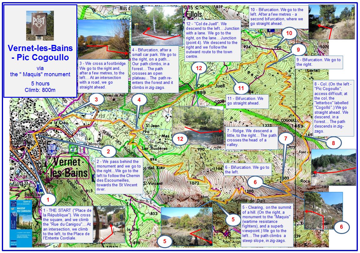
1 - THE START ('Place de la République'). We cross the square, and we climb the 'Rue du Canigou'... At an intersection, we climb to the left, to the Place de l'Entente Cordiale.
2 - We pass behind the monument and we go to the right... We go to the left to follow the Chemin des Escoumeilles, towards the St-Vincent river.
3 - We cross a footbridge. We go to the right and, after a few metres, to the left... At an intersection with a road, we go straight ahead.
4 - Bifurcation, after a small car park. We go to the right, on a path... Our path climbs, in a forest... The path crosses a semi-open plateau... The path re-enters the forest and it climbs in zig-zags.
5 - Clearing, on the summit of a hill. (On the right, a monument to the 'Maquis' (wartime resistance fighters), and a superb viewpoint.) We go to the left... The path climbs a steep slope, in zig-zags.
6 - Bifurcation. We go to the left.
7 - Ridge. We descend a little, to the right... The path crosses the head of a valley.
8 - Col. (On the left - 'Pic Cogoullo', access difficult; at the col, the 'letterbox' labelled 'Cogollo'.) We go to the right. We descend, in a forest... The path descends in zig-zags.
9 - Bifurcation. We go to the right.
10 - Bifurcation. We go to the left. After a few metres - a second bifurcation, where we go straight ahead.
11 - Bifurcation. We go straight ahead.
12 - 'Col de Juell'. We descend to the left... Junction with a lane. We go to the right, on the lane... Junction (point 4). We descend to the right and we follow the outward route to the town centre.
2025